Browse Digital Heritage
Search
Sort
Community
- (-) Remove Hoonah Community Members filter Hoonah Community Members
Collection
- Floyd and Marjorie Peterson Collection (35) Apply Floyd and Marjorie Peterson Collection filter
- Paul Rudolph Collection (35) Apply Paul Rudolph Collection filter
- Marlene Johnson Collection (21) Apply Marlene Johnson Collection filter
- Library of Congress (20) Apply Library of Congress filter
- Mary Peterson Collection (15) Apply Mary Peterson Collection filter
- Sven and Pauline Andersson Collection (9) Apply Sven and Pauline Andersson Collection filter
- Gordon and Chris Greenwald Collection (8) Apply Gordon and Chris Greenwald Collection filter
- Edwina White Collection (7) Apply Edwina White Collection filter
- Ruth James Collection (7) Apply Ruth James Collection filter
- Welsh Family Photo Collection (7) Apply Welsh Family Photo Collection filter
- Bill Wilson, Jr. Collection (3) Apply Bill Wilson, Jr. Collection filter
- Elsie Emery Collection (2) Apply Elsie Emery Collection filter
- James Mackovjak (1) Apply James Mackovjak filter
- National Museum of the American Indian (1) Apply National Museum of the American Indian filter
Digital Heritage
Community
Hoonah Community MembersCategory
People and PlacesSummary
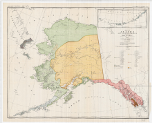
This map shows the geographical locations of the major tribes that existed in 1880 in the Territory of Alaska. 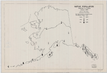
Digital Heritage
Community
Hoonah Community MembersCategory
People and PlacesSummary
This map shows the number of Eskimo, Aleut and Indian people and their distribution within the state in 1942.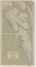
Digital Heritage
Community
Hoonah Community MembersCategory
People and PlacesSummary
Map shows Admiralty, Baranof and Chichagof islands with named locations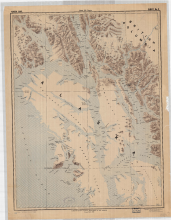
Digital Heritage
Community
Hoonah Community MembersCategory
People and PlacesSummary
The area covered in this map shows most of the territory of the Tlingit people.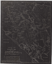
Digital Heritage
Community
Hoonah Community MembersCategory
People and PlacesSummary
This map shows Glacier Bay and its mountain peak names, mountain elevations, the direction of the flow of ice and glacier positions where they meet the saltwater in 1926.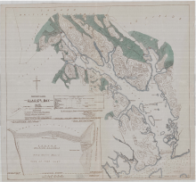
Digital Heritage
Community
Hoonah Community MembersCategory
People and PlacesSummary
This map shows the location of current glaciers and where they were located at the time of being recorded by Capt. Vancouver in 1796.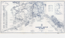
Digital Heritage
Community
Hoonah Community MembersCategory
People and PlacesSummary
This map shows the locations and names of the salmon canneries that were operating in Alaska in 1949.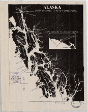
Digital Heritage
Community
Hoonah Community MembersCategory
People and PlacesSummary
This map shows the names and locations of the major fish companies operating in Southeast Alaska in 1903.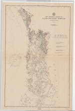
Digital Heritage
Community
Hoonah Community MembersCategory
People and PlacesSummary
Alaska and Canada boundary is decided through binding arbitration from an international tribunal in 1903.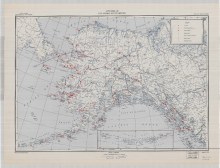
Digital Heritage
Community
Hoonah Community MembersCategory
People and PlacesSummary
This map shows the territory wide distribution of hospitals, Native schools, Native stores, medical services and radio stations present in 1947.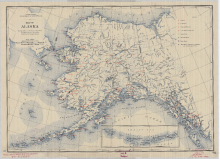
Digital Heritage
Community
Hoonah Community MembersCategory
People and PlacesSummary
This map shows the territory wide distribution of hospitals, Native schools, Native stores, medical services, and radio stations present in 1940. 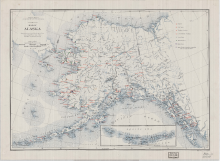
Digital Heritage
Community
Hoonah Community MembersCategory
People and PlacesSummary
This map shows the territory wide distribution of hospitals, Native schools, Native stores, medical services and radio stations in 1937.