Alexander Archipelago 1898 Map

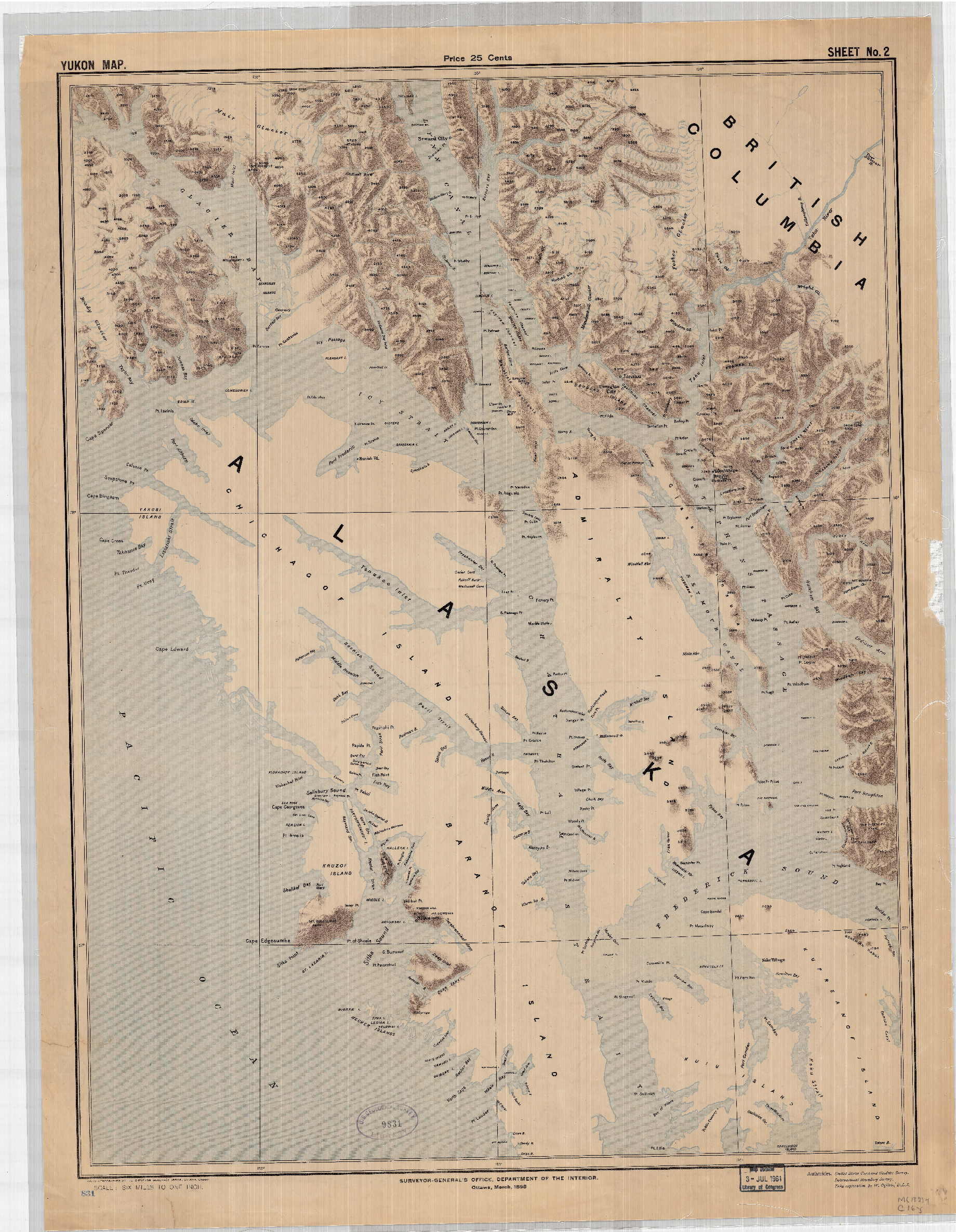
The Alexander Archipelago is a large group of islands that extends from Cross Sound and Icy Straits to Dixon Entrance. A distance of about 280 miles. It is made up of about 1,100 islands and is sandwiched between the Pacific Ocean and the Canadian border. It is the exclusive home of the Tlingit people.
It was given this name by the U.S. Coast and Geodetic survey in 1867 in honor of Alexander II, the tsar of Russia.
Glacier Bay National Park and Preserve, Sitka National Historical Park, Admiralty and Misty Fjords national monuments are found in the Alexander Archipelago. The Tongass National Forest covers most the Archipelago.
The center of the map show the ABC islands; Admiralty, Baranof and Chichagof. On Chichagof Island is the town of Hoonah the largest Tlingit village, and current home of the Xunaa Kaawu (indigenous people of Hoonah). Just north of Chichagof across Icy Straits is Glacier Bay the ancestral home of Xunaa Kaawu before the Little Ice Age.
It is interesting to note the lack of detail for Chichagof Island might be due to the lack of capitalistic interest of this area at the time. The areas of detail were of much more involved in large capital investments at this point in time (circa 1898), demanding much more geographic details than the ABC islands.