Library of Congress
Library of Congress
In this collection
Items in Collection:
Digital Heritage
Community
Hoonah Community MembersCategory
People and PlacesSummary
The area covered in this map shows most of the territory of the Tlingit people.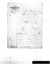
Digital Heritage
Community
Hoonah Community MembersCategory
Church and FaithSummary
The Hoonah people have made numerous requests to the Russian Orthodox leadership asking that a church be built in Hoonah. In their frustration they ask their priest Alexander if he could write a letter to those in charge of building churches.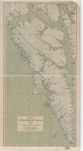
Digital Heritage
Community
Hoonah Community MembersCategory
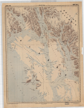
People and PlacesSummary
Map shows Admiralty, Baranof and Chichagof islands with named locations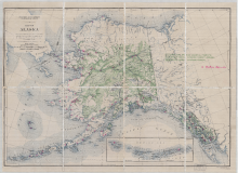
Digital Heritage
Community
Hoonah Community MembersCategory
People and PlacesSummary
Locations of Natives Schools throughout Alaska 1927, US Geological Survey.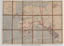
Digital Heritage
Community
Hoonah Community MembersCategory
People and PlacesSummary
District boundaries, proposed schools, and current existing schools.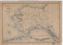
Digital Heritage
Community
Hoonah Community MembersCategory
People and PlacesSummary
This map shows the distribution of Native schools throughout the Territory of Alaska at this time period.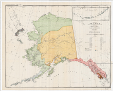
Digital Heritage
Community
Hoonah Community MembersCategory
People and PlacesSummary
This map shows the geographical locations of the major tribes that existed in 1880 in the Territory of Alaska. 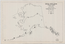
Digital Heritage
Community
Hoonah Community MembersCategory
People and PlacesSummary
This map shows the number of Eskimo, Aleut and Indian people and their distribution within the state in 1942.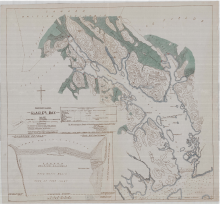
Digital Heritage
Community
Hoonah Community MembersCategory
People and PlacesSummary
This map shows the location of current glaciers and where they were located at the time of being recorded by Capt. Vancouver in 1796.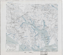
Digital Heritage
Community
Hoonah Community MembersCategory
People and PlacesSummary
This map shows the major mountain peaks and positions of the major glaciers in 1937.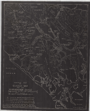
Digital Heritage
Community
Hoonah Community MembersCategory
People and PlacesSummary
This map shows Glacier Bay and its mountain peak names, mountain elevations, the direction of the flow of ice and glacier positions where they meet the saltwater in 1926.
Digital Heritage
Community
Hoonah Community MembersCategory
People and PlacesSummary
This map records the changes in the glaciers of Glacier Bay between 1879 and 1912.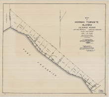
Digital Heritage
Community
Hoonah Community MembersCategory
People and PlacesSummary
A territorial survey of the City of Hoonah in 1932. 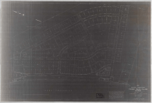
Digital Heritage
Community
Hoonah Community MembersCategory
People and PlacesSummary
This map shows how the community of Hoonah was organized one year after the town had completely burned the ground.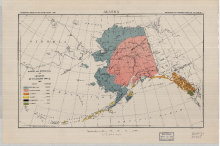
Digital Heritage
Community
Hoonah Community MembersCategory
People and PlacesSummary
The map shows the distribution of the different indigenous people of Alaska based on linguistic stock that was reported in 1920.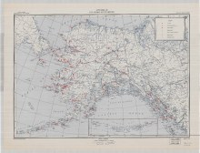
Digital Heritage
Community
Hoonah Community MembersCategory
People and PlacesSummary
This map shows the territory wide distribution of hospitals, Native schools, Native stores, medical services and radio stations present in 1947.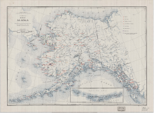
Digital Heritage
Community
Hoonah Community MembersCategory
People and PlacesSummary
This map shows the territory wide distribution of hospitals, Native schools, Native stores, medical services and radio stations in 1937.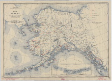
Digital Heritage
Community
Hoonah Community MembersCategory
People and PlacesSummary
This map shows the territory wide distribution of hospitals, Native schools, Native stores, medical services, and radio stations present in 1940. 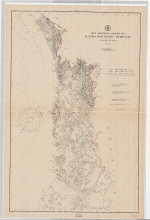
Digital Heritage
Community
Hoonah Community MembersCategory
People and PlacesSummary
Alaska and Canada boundary is decided through binding arbitration from an international tribunal in 1903.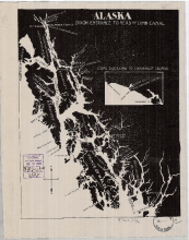
Digital Heritage
Community
Hoonah Community MembersCategory
People and PlacesSummary
This map shows the names and locations of the major fish companies operating in Southeast Alaska in 1903.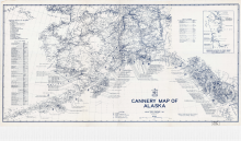
Digital Heritage
Community
Hoonah Community MembersCategory
People and PlacesSummary
This map shows the locations and names of the salmon canneries that were operating in Alaska in 1949.