Skip to main content
Log in
Toggle navigation
Menu
About
Browse
Categories
Collections
Home
Map
Map
Last changed on Wed, 12/31/1969 - 16:00
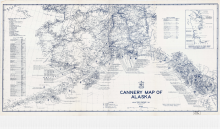
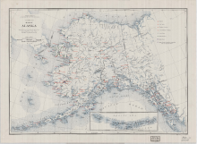
Alaska Southern Fish and Fisheries Cannery Map 1941
Digital Heritage
Community
Hoonah Community Members
Category
People and Places
Summary
This map shows the locations and names of the salmon canneries that were operating in Alaska in 1949.
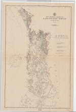
Alaska Southeastern Coasts 1903 Map
Digital Heritage
Community
Hoonah Community Members
Category
People and Places
Summary
This map shows the names and locations of the major fish companies operating in Southeast Alaska in 1903.
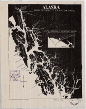
Map of Alaska Southeastern and British Columbia Boundaries 1903
Digital Heritage
Community
Hoonah Community Members
Category
People and Places
Summary
Alaska and Canada boundary is decided through binding arbitration from an international tribunal in 1903.
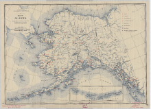
Alaska Indians Activities of the Office of Indian Affairs 1940 Map
Digital Heritage
Community
Hoonah Community Members
Category
People and Places
Summary
This map shows the territory wide distribution of hospitals, Native schools, Native stores, medical services, and radio stations present in 1940.
Alaska Indians Activities of the Office of Indian Affairs 1937 Map
Digital Heritage
Community
Hoonah Community Members
Category
People and Places
Summary
This map shows the territory wide distribution of hospitals, Native schools, Native stores, medical services and radio stations in 1937.
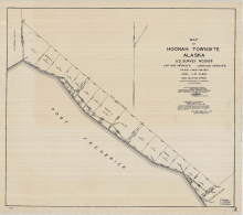
Alaska Hoonah City 1932 Survey Map
Digital Heritage
Community
Hoonah Community Members
Category
People and Places
Summary
A territorial survey of the City of Hoonah in 1932.
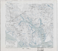
Alaska Glacier Bay Grand Pacific Glacier 1879 & 1912 Map
Digital Heritage
Community
Hoonah Community Members
Category
People and Places
Summary
This map records the changes in the glaciers of Glacier Bay between 1879 and 1912.
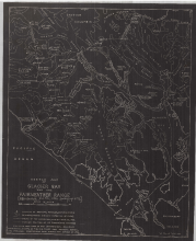
Alaska Glacier Bay and Fairweather Range 1926 Map
Digital Heritage
Community
Hoonah Community Members
Category
People and Places
Summary
This map shows Glacier Bay and its mountain peak names, mountain elevations, the direction of the flow of ice and glacier positions where they meet the saltwater in 1926.
Alaska Glacier Bay 1937 Map
Digital Heritage
Community
Hoonah Community Members
Category
People and Places
Summary
This map shows the major mountain peaks and positions of the major glaciers in 1937.
1
2
next
last