Browse Digital Heritage
Digital Heritage
Community
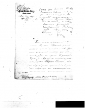
Hoonah Community MembersCategory
Church and FaithSummary
Requests from the Hoonah people to Priest Alexander to ask for a church and bell to be placed in Hoonah. The priest passes these requests on in a letter to the Russian Church hierarchy.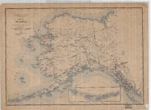
Digital Heritage
Community
Hoonah Community MembersCategory
People and PlacesSummary
This map shows the distribution of Native schools throughout the Territory of Alaska at this time period.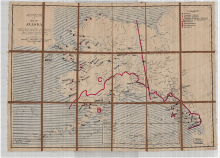
Digital Heritage
Community
Hoonah Community MembersCategory
People and PlacesSummary
District boundaries, proposed schools, and current existing schools.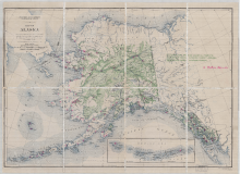
Digital Heritage
Community
Hoonah Community MembersCategory
People and PlacesSummary
Locations of Natives Schools throughout Alaska 1927, US Geological Survey.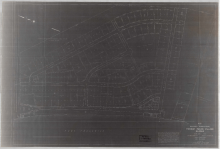
Digital Heritage
Community
Hoonah Community MembersCategory
People and PlacesSummary
This map shows how the community of Hoonah was organized one year after the town had completely burned the ground.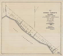
Digital Heritage
Community
Hoonah Community MembersCategory
People and PlacesSummary
A territorial survey of the City of Hoonah in 1932. 
Digital Heritage
Community
Hoonah Community MembersCategory
People and PlacesSummary
This map records the changes in the glaciers of Glacier Bay between 1879 and 1912.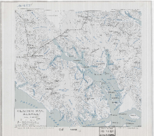
Digital Heritage
Community
Hoonah Community MembersCategory
People and PlacesSummary
This map shows the major mountain peaks and positions of the major glaciers in 1937.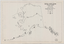
Digital Heritage
Community
Hoonah Community MembersCategory
People and PlacesSummary
This map shows the number of Eskimo, Aleut and Indian people and their distribution within the state in 1942.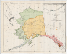
Digital Heritage
Community
Hoonah Community MembersCategory
People and PlacesSummary
This map shows the geographical locations of the major tribes that existed in 1880 in the Territory of Alaska. 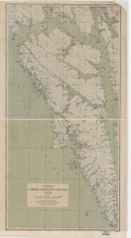
Digital Heritage
Community
Hoonah Community MembersCategory
People and PlacesSummary
Map shows Admiralty, Baranof and Chichagof islands with named locations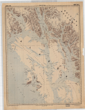
Digital Heritage
Community
Hoonah Community MembersCategory
People and PlacesSummary
The area covered in this map shows most of the territory of the Tlingit people.