Browse Digital Heritage
Digital Heritage
Community
Hoonah Community MembersCategory
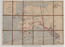
People and PlacesSummary
District boundaries, proposed schools, and current existing schools.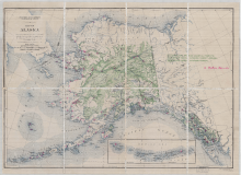
Digital Heritage
Community
Hoonah Community MembersCategory
People and PlacesSummary
Locations of Natives Schools throughout Alaska 1927, US Geological Survey.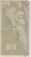
Digital Heritage
Community
Hoonah Community MembersCategory
People and PlacesSummary
Map shows Admiralty, Baranof and Chichagof islands with named locations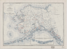
Digital Heritage
Community
Hoonah Community MembersCategory
People and PlacesSummary
This map shows the territory wide distribution of hospitals, Native schools, Native stores, medical services and radio stations in 1937.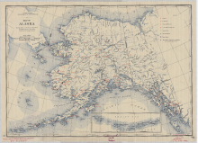
Digital Heritage
Community
Hoonah Community MembersCategory
People and PlacesSummary
This map shows the territory wide distribution of hospitals, Native schools, Native stores, medical services, and radio stations present in 1940.